

Offline Maps, GPS, Speedometer
Appcentric Team
I like navigation apps that solve a clear problem without forcing me to rebuild my whole driving routine. Offline Maps, GPS, Speedometer aims at exactly that: it combines map access with driving-focused information, including speed-camera radar, police alerts, traffic warnings, and a speedometer. I reviewed it as a practical Maps & Navigation app rather than as a replacement for every navigation tool on my phone, and that distinction matters.
The starting condition is easy to understand. You are about to drive somewhere, mobile coverage may be unreliable, and you want more awareness of what is happening on the road. The app’s store summary focuses on safer driving through real-time alerts, while its short description emphasizes offline maps. Those two ideas work well together, but they also create different expectations: offline route guidance is one job, live road intelligence is another. The best experience comes from knowing which part you need before you leave.
My overall impression is that this is most useful as a driving companion, especially for people who want map access and road warnings in one place. It is free, rated for Everyone, and developed by Appcentric Team. Its average rating is 4.3 from around 17 thousand ratings, with over 10 million installs, so it has clearly reached a large audience without being positioned as a premium-only tool.
From planning a trip to finishing the drive
Begin with the route, not the alert list
My first recommendation is to treat the map as the foundation. Before moving, I would decide where the offline part of the trip matters most: a rural stretch, an underground car park, a border crossing, or any route where a weak signal could make a normal online map frustrating. Preparing that part before departure is more useful than opening the app only after the connection has already disappeared.
This is also where the app’s name can cause a small misunderstanding. “Offline Maps” sounds like the entire driving experience works without a connection, but speed-camera, police, and traffic information are naturally more dependent on current information. I would use the offline map for continuity and regard live alerts as an additional layer that is strongest when the app can receive fresh road information. That distinction helps avoid relying on a warning system as though it were a permanent substitute for attentive driving.
Latest News

Uber Eats Under Pressure: What Happens When Delivery Goes Wrong

How QR & Barcode Scanner Adapts to Android and iOS Innovations

Why Waze Navigation & Live Traffic Is Your Essential Travel Companion

CapCut Mastery: Unleash Hidden Features for Pro-Level Editing

How OS Updates Enhance Roblox Adventures

Teacher Simulator: Exam Time Turns Quick Classroom Judgments into a Repetitive Loop
For a short familiar trip, I would not spend much time configuring anything. For an unfamiliar journey, I would check the route while stationary, make sure the map view is readable, and decide where the phone will sit. A dashboard position that causes glare or requires looking down undermines the safety benefit of any alert. The app can support awareness, but it cannot make unsafe phone handling acceptable.
Use the speedometer as a reference, not a permission slip
The speedometer is a useful part of the workflow when the vehicle’s own display is hard to read or when I want a second visual reference. It can be especially convenient in an older car, a rental vehicle, or a situation where the dashboard is partly hidden by the steering wheel. Still, I would treat the car’s built-in instrument as the primary reference whenever there is a disagreement. Phone-based readings can be affected by positioning, signal conditions, and how the device is mounted.
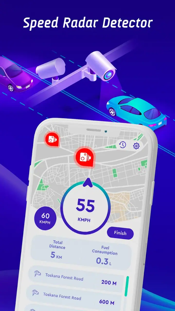
There is a practical benefit to keeping the speed display and navigation context together: I do not need to switch between a map and a separate speed app. The trade-off is visual density. A screen showing route information, speed, and warnings can become distracting if I try to read every element while moving. I found the most sensible workflow to be setting the view before departure, then using brief glances rather than interacting with the phone during the drive.
Gallery
Let alerts support attention rather than replace it
Speed-camera and police alerts can be useful reminders to check my speed and road behavior. Traffic alerts can also help explain why a route is slowing down. But I would never interpret an alert as a complete description of the road ahead. Coverage can vary, information can become outdated, and no app can identify every temporary change, enforcement location, hazard, or local rule.
The strongest habit is to respond to an alert by becoming more attentive, not by making a sudden maneuver. If a warning appears, I would keep my lane, follow posted signs, and adjust speed smoothly and legally. This sounds obvious, but it is an important limitation of alert-based driving tools: they can improve awareness only when the driver uses them calmly.
Understand the handoff between offline and live information
The most important handoff in this app is between stored map material and current road information. An offline map can keep the basic journey usable when the network weakens. A live traffic or enforcement warning, however, is a different kind of information because its value depends on being current. I would therefore plan the route offline, check current conditions before leaving, and avoid assuming that every alert category remains equally useful after the connection is lost.
This approach also answers a question many people have before installing it: can it replace a conventional online navigation service? For some trips, it may cover the essentials. For complex urban travel, frequent route changes, or journeys where current congestion is the deciding factor, I would still prefer a full online navigation service as the main tool and use this app for its driving-oriented focus. The choice depends less on the app’s map label and more on whether your trip is stable or constantly changing.
Finish the trip without creating a second task
At the end of a drive, the useful outcome is not simply arriving with a warning displayed. It is arriving without repeatedly touching the phone, without following an outdated route into trouble, and without allowing alerts to compete with signs and traffic. I would close the navigation view only after parking, then make any route or display changes before the next journey rather than while stopped briefly at a light.
This sounds like a small workflow detail, but it is one of the app’s practical strengths: it encourages a single driving screen instead of a chain of separate apps. The less often I need to switch tools, the easier it is to keep the phone in a fixed position and maintain attention on the road.
Where the workflow breaks down
The first weak point is the tension between offline maps and real-time alerts. Offline access is valuable precisely when connectivity is poor, while real-time information is valuable precisely when it is current. The app brings both ideas together, but users should not treat them as identical capabilities. If your main reason for installing it is live traffic accuracy, an online service with a stronger traffic ecosystem may be a better primary choice.
The second weak point is the possibility of overconfidence. A warning system can make a driver feel protected, even though alerts are not a guarantee that a road is clear, legal, or safe. I would skip this app if you are looking for an automated driving assistant that makes decisions for you. It is a reference tool, not a substitute for signs, road markings, local regulations, or judgment.
A third friction point is the screen itself. Combining navigation, speed, and warnings sounds efficient, but a busy display is not automatically a better display. Drivers who prefer an extremely simple turn-by-turn interface may find a dedicated navigation app less distracting. Conversely, drivers who regularly want a speedometer and road-warning context may appreciate having those functions closer together.
Who will get the most from it?
I would recommend it to drivers who travel through areas with uneven coverage, people who want an offline map option, and anyone who prefers a driving-centered tool rather than a general-purpose map with many unrelated functions. It also makes sense for occasional road trips where preparing a route in advance is more important than constantly recalculating it.
It is less suitable for someone who needs highly detailed public-transit planning, walking directions as the main use case, or sophisticated live rerouting in dense city traffic. Those needs are usually better served by a broader navigation platform built around constantly changing online data. I would also skip it if you expect every speed-camera or police warning to be perfectly complete, because that expectation would be unsafe with any alert app.
Small habits that improve the experience
One useful habit is to separate preparation from driving. Load or inspect the route while parked, choose the display that requires the fewest glances, and mount the phone before the vehicle moves. This turns the app from something you operate continuously into something you configure once and consult briefly.
Another is to compare the app’s route with the road signs when conditions change. If a diversion appears, a road closes, or a local restriction conflicts with the suggested path, the physical signs win. Offline guidance is most helpful as a continuity layer, not as an authority above the road itself.
A third is to use the speedometer to notice trends rather than chase exact readings. If the display suggests that your speed is creeping upward, that reminder is useful. It is not a reason to stare at the number or to make abrupt corrections. The best use is quiet feedback that supports smoother driving.
Finally, I would test the app on a familiar route before committing to it for an important journey. That lets you learn how the map view feels, how much information appears at once, and whether the offline workflow matches your expectations. A short test is more valuable than discovering during a long trip that you prefer a different navigation layout.
Compatibility and everyday practicality
The app was released on May 16, 2023, and the current version is 1.3.22. It supports devices running Android 7.0 or later, which gives it a broad reach among Android users with older phones as well as newer models. Since it is free, trying it alongside an existing navigation app does not require a purchase decision, although switching between apps while driving would be a poor workflow. Compare them before setting off, then choose one primary screen.
The Everyone content rating also makes it straightforward for a family device or a shared phone, but an age rating does not change the driving responsibility. A younger passenger might explore the app while parked, yet the driver should be the person making route decisions and responding to road conditions.
My final take after following the full workflow
Offline Maps, GPS, Speedometer is at its best when I start with a clear need: maintain map access, keep a visible speed reference, and receive driving-related warnings without assembling several separate tools. Its real value appears in the handoffs. I can prepare a route before leaving, continue with map guidance when coverage is unreliable, and use alerts as prompts for better attention when current information is available.
It is not the right choice for every trip. A full online navigation service may be better for complex rerouting, while a simpler map may be better for drivers who dislike a busy screen. The app’s warnings should never be treated as complete or infallible, and its offline capability should not be confused with guaranteed live information without connectivity.
Even with those limits, I think it is worth trying if you want a free Android driving companion with an offline-first angle and a speedometer built into the same general experience. I would recommend testing it on a familiar journey, preparing the route while parked, and keeping expectations realistic. Used that way, it becomes a practical aid rather than a distracting promise: helpful information before and during a drive, with the driver still firmly in control.
FAQs for Offline Maps, GPS, Speedometer
How accurate is the GPS feature in Offline Maps, GPS, Speedometer?
The GPS feature in Offline Maps, GPS, Speedometer is generally very accurate, providing precise location tracking even when offline. It uses your device's built-in GPS capabilities, ensuring reliable navigation. However, accuracy can vary slightly depending on your device and environmental factors such as tall buildings or dense forests.
Can I use the Offline Maps feature without an internet connection?
Yes, you can use the Offline Maps feature without an internet connection. The app allows you to download maps in advance, enabling navigation and location services even when you're offline. This is especially useful for traveling in areas with poor network coverage or when you want to save on data usage.
What types of maps are available in the app?
The app offers a variety of maps, including street maps, satellite views, and terrain maps. Users can choose the type of map that best suits their needs, whether for urban navigation or exploring outdoor trails. The variety ensures that you have the flexibility to switch between different views as required.
Does the app consume a lot of battery power?
While using GPS and offline maps can consume more battery than standard apps, Offline Maps, GPS, Speedometer is optimized for efficiency. It includes features to help manage battery usage, such as dimming the screen during navigation. However, it's always a good idea to have a charger handy for longer trips.
Is the speedometer feature reliable for tracking speed?
The speedometer feature in the app is quite reliable, utilizing your device's GPS to track speed accurately. It updates in real-time, providing current speed readings that are useful for drivers and cyclists. However, it should not replace a vehicle's built-in speedometer, as occasional discrepancies may occur.
Pros
- Works without internet connection.
- Accurate GPS tracking.
- Customizable map views.
- Includes speedometer feature.
- Low battery consumption.
Cons
- Limited map updates.
- Ads in free version.
- No real-time traffic info.
- Smaller map database.
- In-app purchases needed.


